Drone Photography and Videography · Mendocino County, California
Mendocino County Drone Photographer.
Drone FAA Part 107-certified aerial photography and cinema.
FAA Part 107 certified commercial drone photography and videography across Mendocino County, a three-platform fleet for coastal weddings, vineyard brand work, real estate, and inspections. Licensed, registered, and insured.
Drone Photography and Videography · Mendocino County
What it actually looks like in Mendocino County.
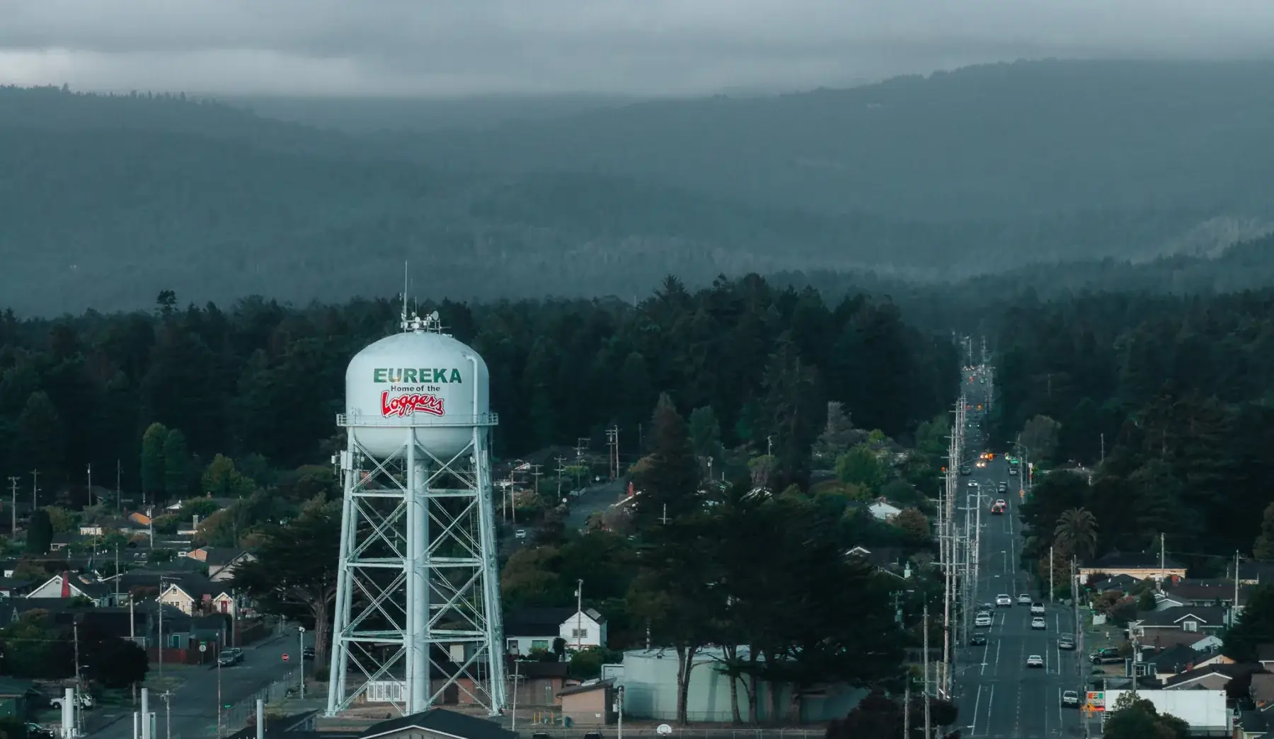
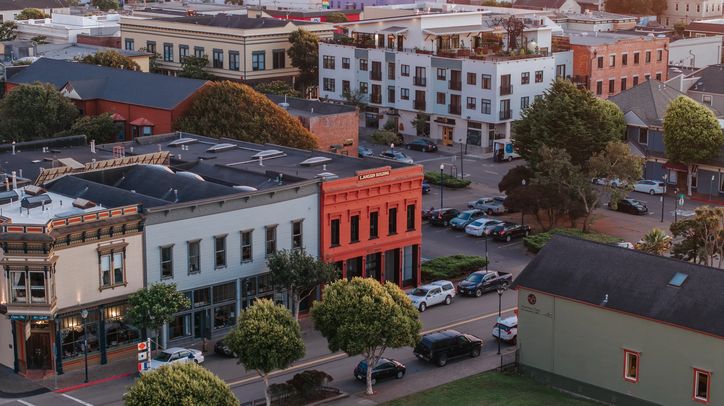
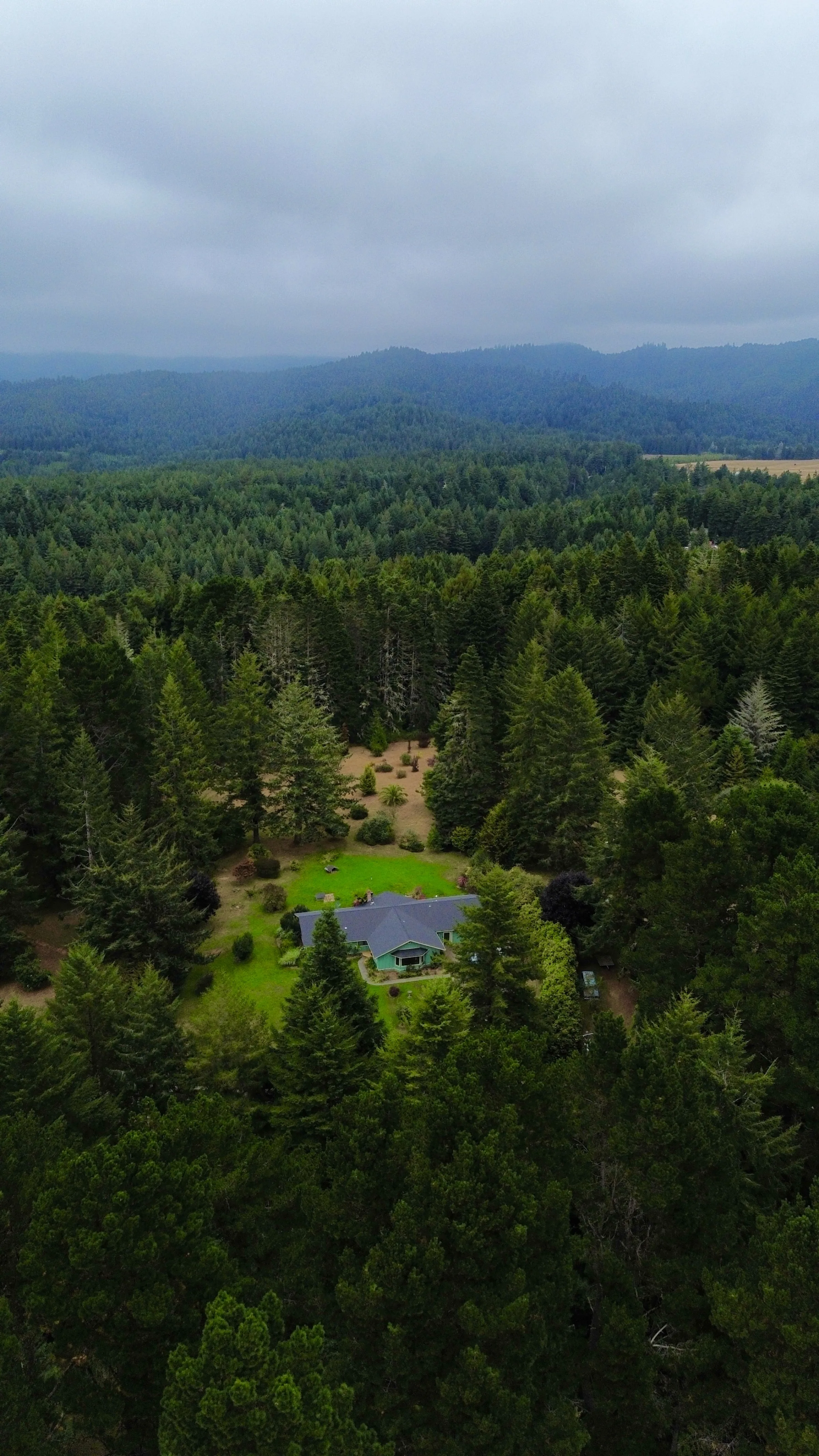
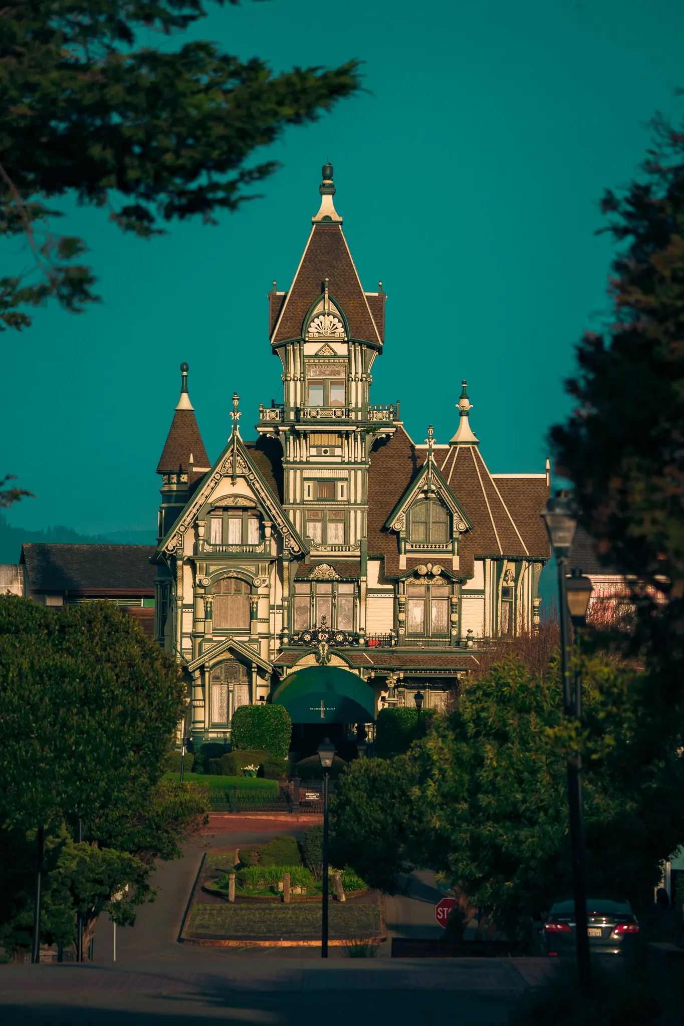
Mendocino drone work covers two distinct geographies: coastal (Mendocino, Fort Bragg, Point Arena, dramatic cliffs and tide pools, all Class G) and inland (Ukiah, Anderson Valley wine country, vineyards and rolling hills, mostly Class G with some Ukiah airport considerations). Different visual language, same three-platform fleet. DJI Mini 3, Mavic 3 Pro, and the Avata 2 FPV.
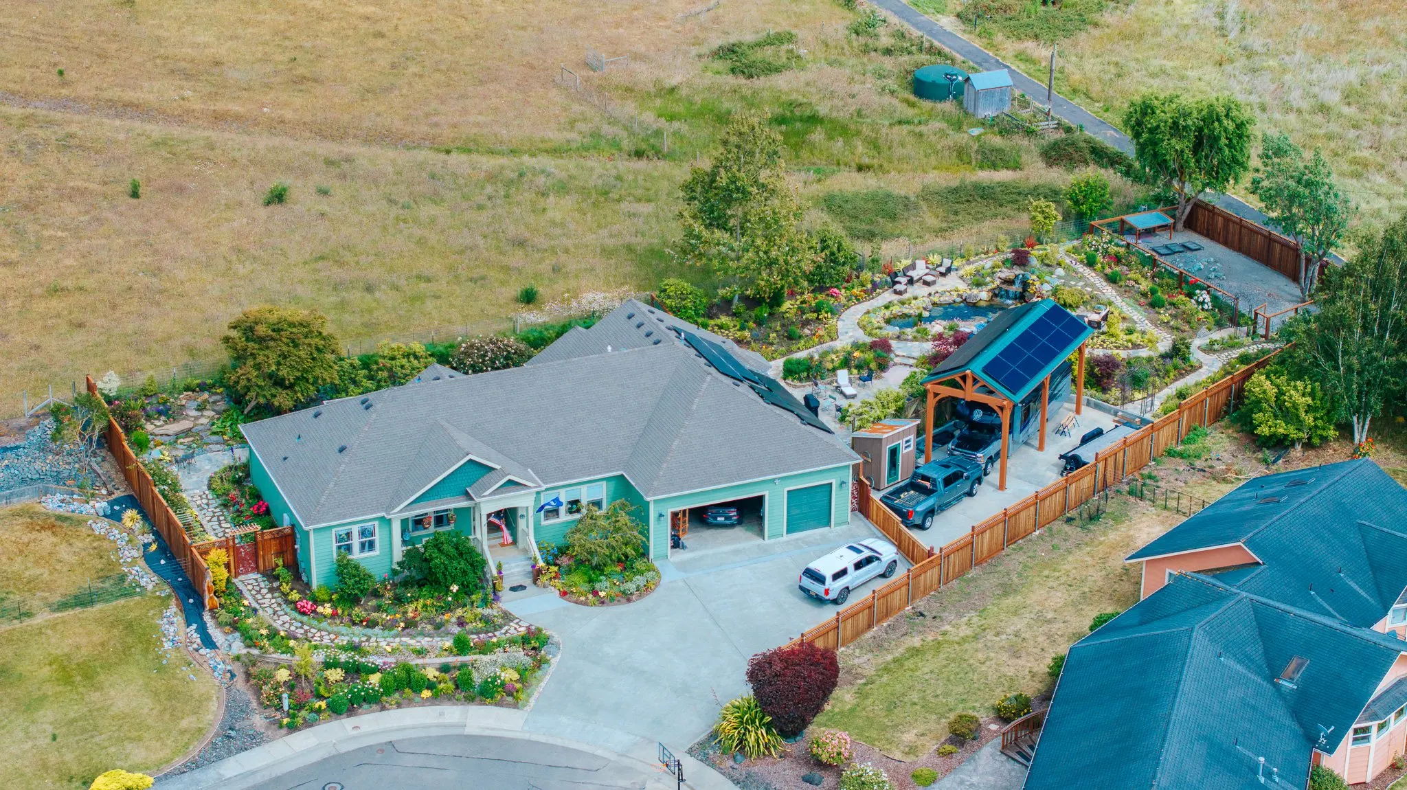
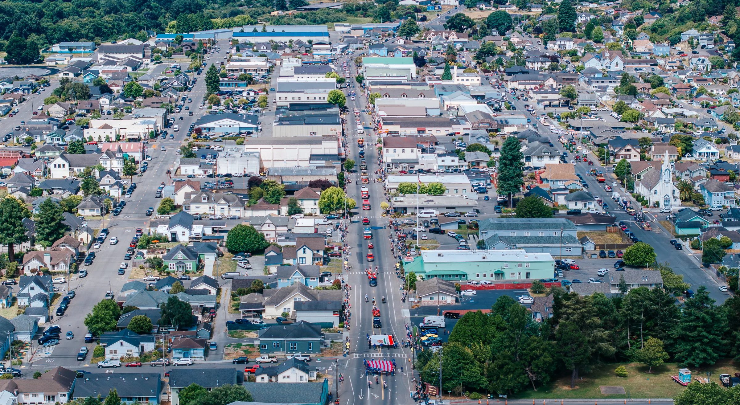
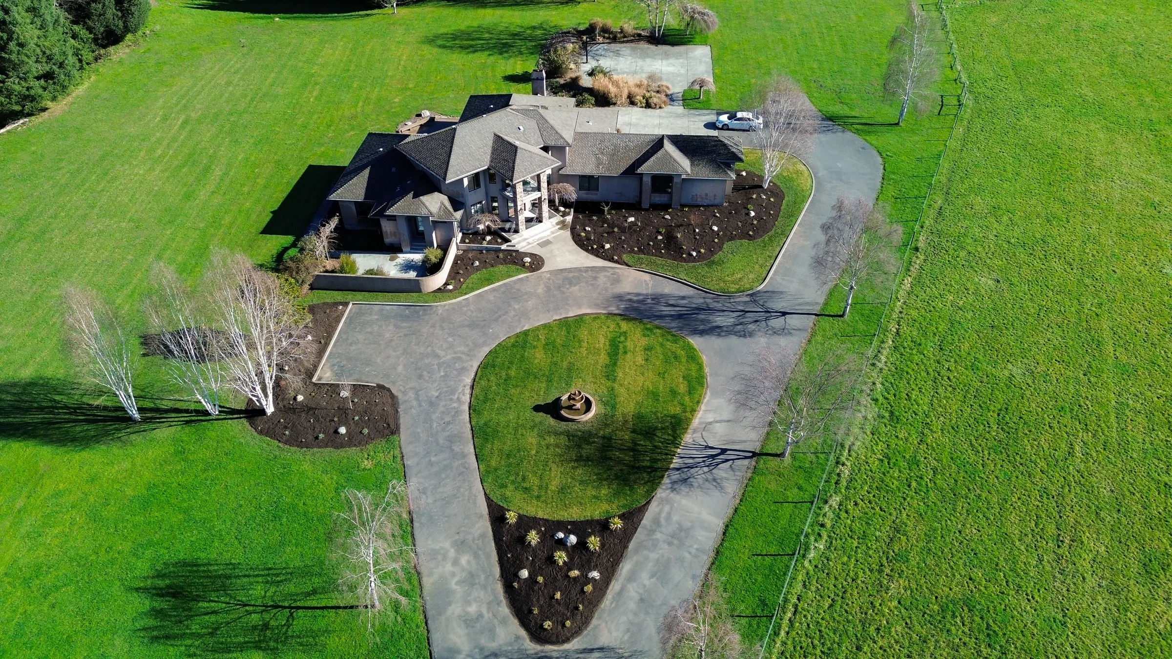
Most Mendocino drone projects are wine-country brand cinematography (vineyard sweeps, harvest aerials, barrel-room reveals) or coastal wedding aerials (Mendocino headland sweeps, Glass Beach detail, Pomo Bluffs reveals). Real estate aerials for Mendocino + Fort Bragg coastal properties are also a steady stream.
Every flight is Part 107 compliant. Unauthorized commercial drone work exposes both the pilot and the client to FAA civil penalties in the tens of thousands per violation, and standard commercial liability insurance won't pay out on a flight that violated FAA regulations. Hiring a registered, insured Part 107 pilot moves that exposure where it belongs, onto the pilot.
Where in Mendocino County
-
Mendocino Headlands Sweep
Cliff-and-coast aerial. Class G. Plan for fog patterns.
-
Anderson Valley Vineyards
Wine-country aerial. Late afternoon for shadow definition.
-
Glass Beach + Pomo Bluffs
Fort Bragg coastal aerial. Tide-dependent ground detail.
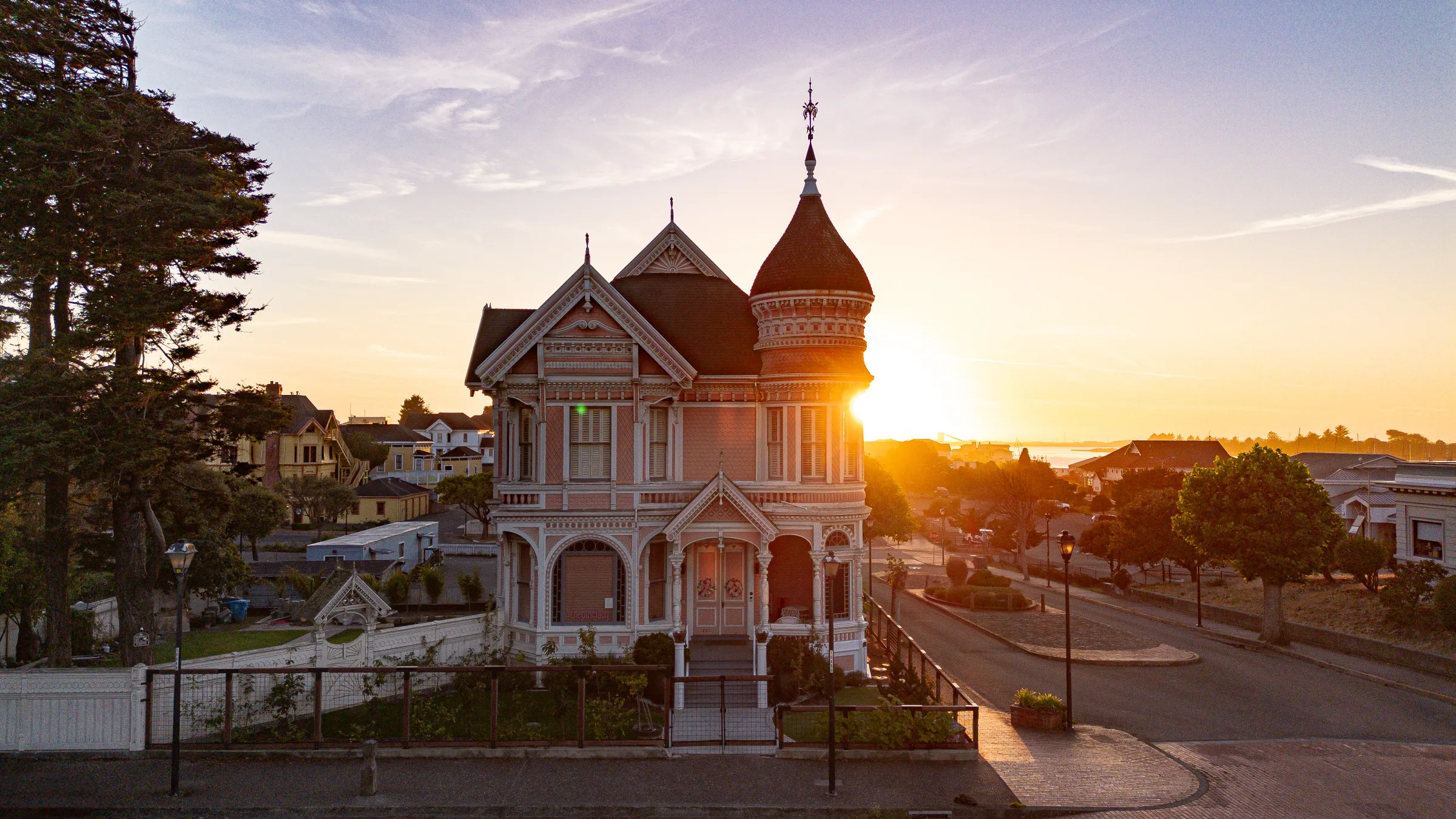
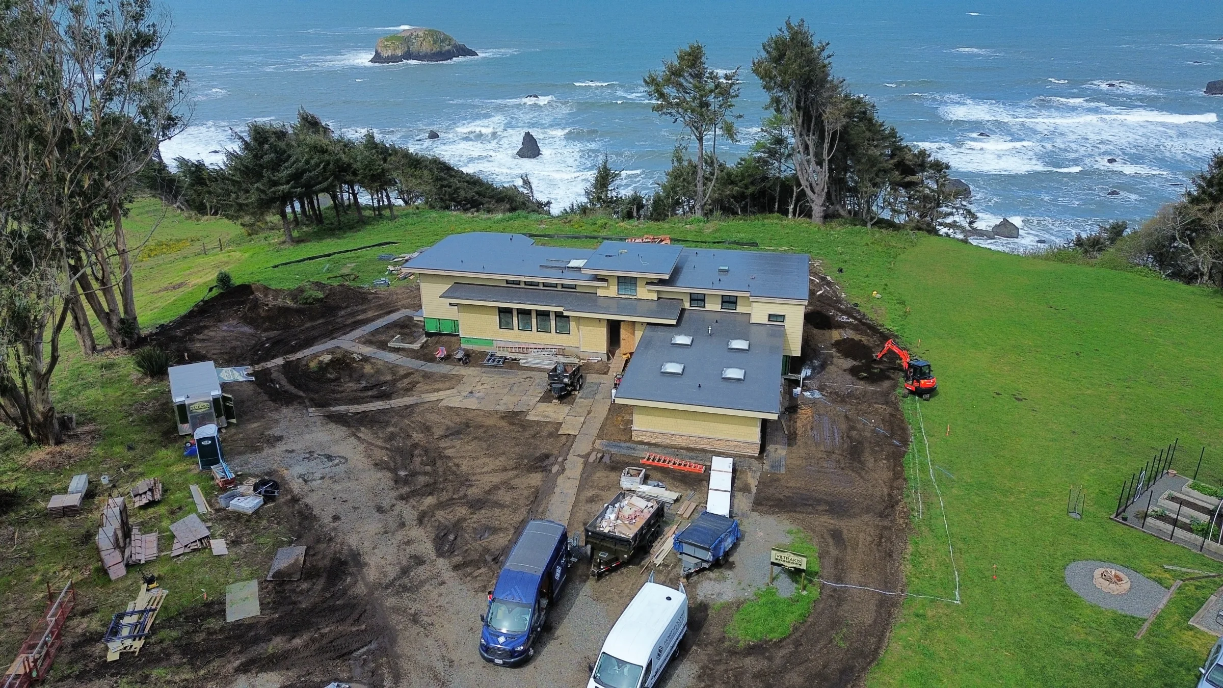
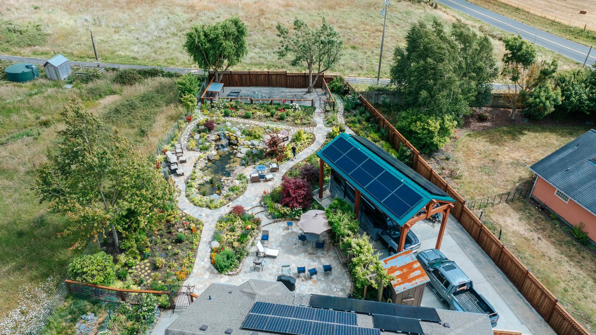
Recent Work
Drone Photography and Videography in Mendocino County. A look at the work.

FAA Part 107 · The Operator
The pilot, on every flight.
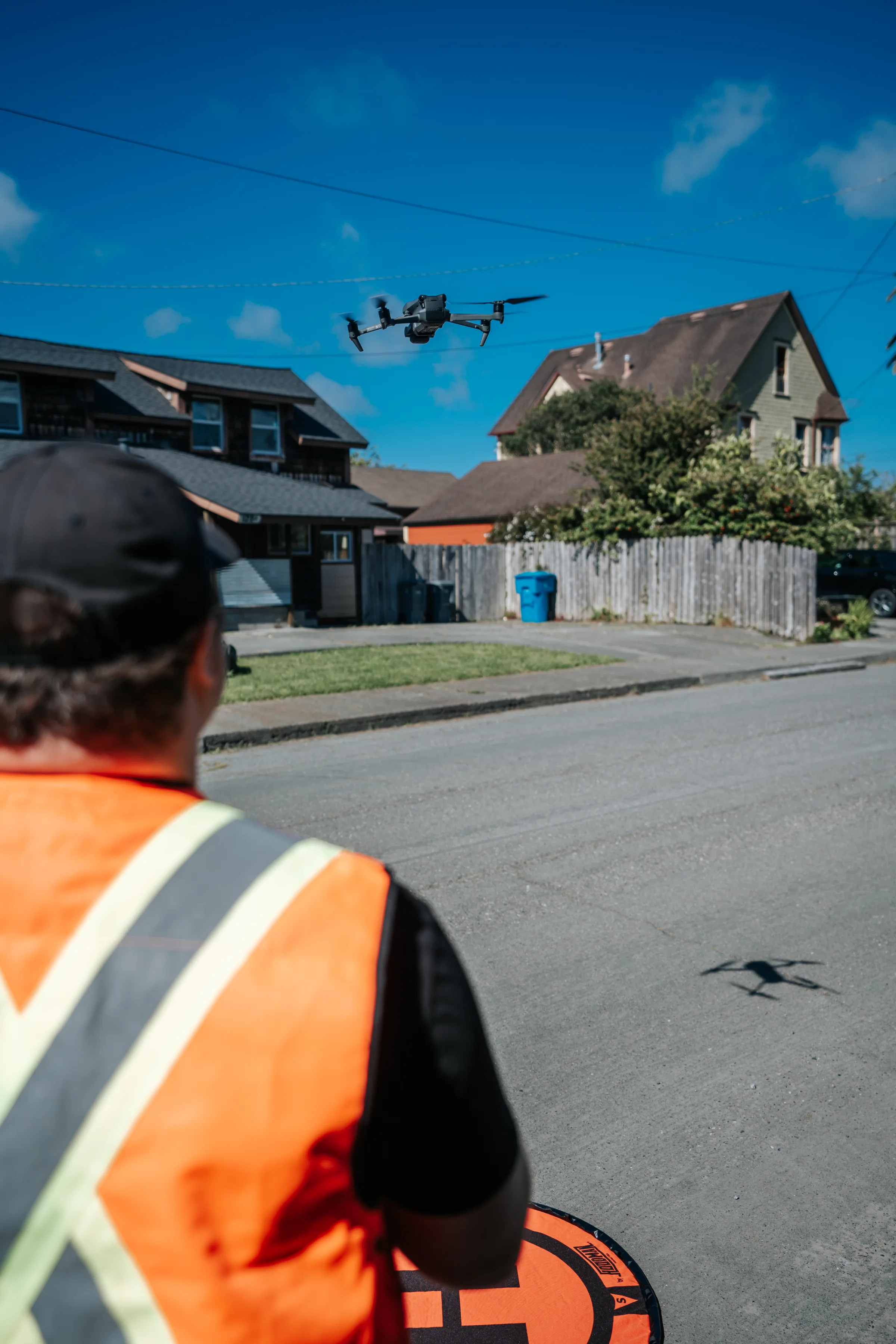
Every Mendocino County drone flight on the calendar is operated personally by Tex. FAA Part 107 commercial Remote Pilot Certificate current and valid, LAANC airspace coordination handled in-house, and a working knowledge of the Mendocino County microclimate and airspace boundaries built from years of regional flight scouting.
What's Included
What you actually get with drone photography and videography.
-
FAA Part 107 Certified Pilot
Current, registered, and current commercial drone pilot license. LAANC airspace authorization for restricted areas. Insurance documentation on request.
-
Three-Platform Drone Fleet
DJI Mini 3 (sub-250g, for tight regulated airspace and travel); DJI Mavic 3 Pro (broadcast-grade 4K cinema, Hasselblad sensor, three-camera array); DJI Avata 2 (cinematic FPV, immersive single-take flythroughs). The right drone for the right job, every time.
-
Pre-Flight Risk Assessment
Documented airspace check, weather review, property-owner permission, and flight plan for every commercial flight.
-
Commercial Insurance
Fully insured for commercial drone operations. Certificate of insurance available before the shoot for venue or client requirements.
-
Edited Aerial Deliverables
Color-graded 4K video clips, high-resolution stills, and any specialty formats (vertical for social, broadcast 16:9, slow-motion sequences).
-
Permit Coordination
FAA LAANC clearance, state park permits, and venue authorizations handled ahead of the shoot, no day-of surprises.
Drone Photography and Videography by City
Drone Photography and Videography across 4 Mendocino County cities.
We work drone photography and videography engagements throughout Mendocino County, from the Eureka studio across the entire county. Click into a city for venue notes and the work I've done there.
-
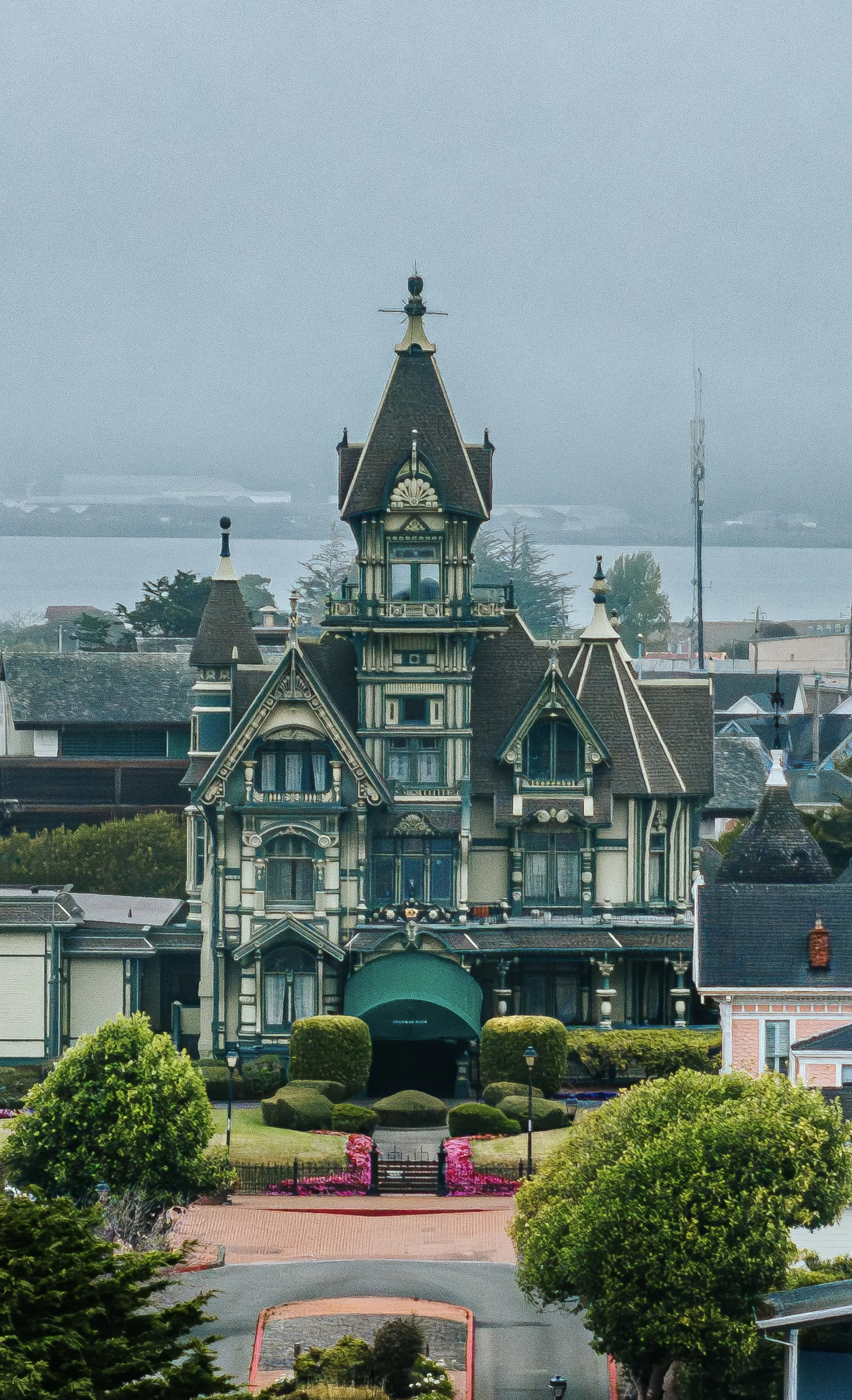
Mendocino
→Headlands, sea-cliffs, and the Victorian village. Class G coastal airspace, no LAANC required for most shoots.
-
Fort Bragg
→Mendocino coast aerial. Glass Beach, Pomo Bluffs, MacKerricher State Park.
-
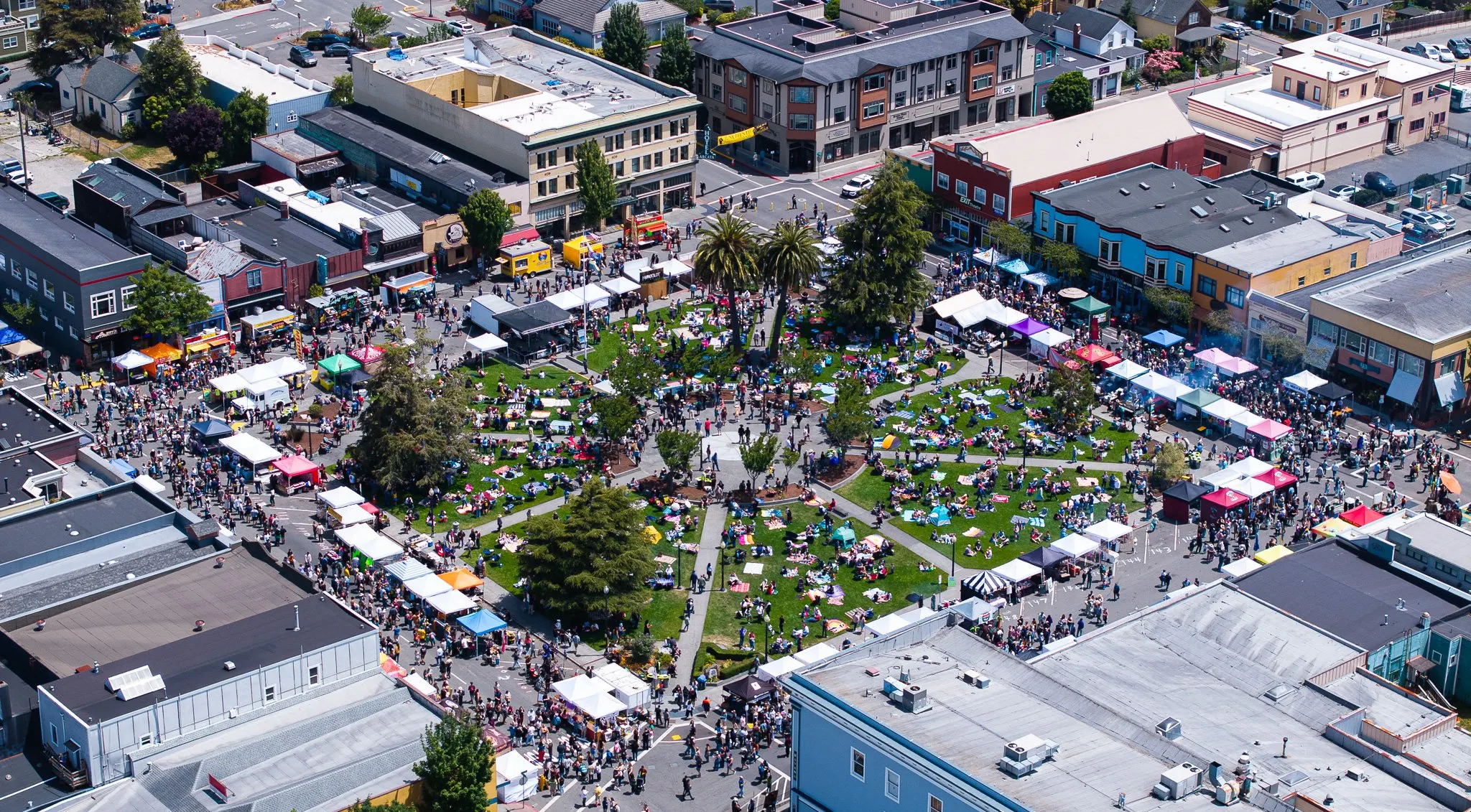
Boonville
→Anderson Valley vineyard rows, tasting-room aerials, and wine-country pattern shots.
-
Point Arena
→Point Arena Lighthouse and Stornetta Public Lands sea-bluff aerial. Class G coastal airspace.
All 4 cities in Mendocino County →
How It Works
From first message to final delivery.
- 01
Inquiry & Scope
Send the location, intended use (real estate, wedding, brand, industrial), and timeline. I pull the airspace map for the location.
- 02
Authorization
LAANC permit if needed (1–14 days lead time depending on airspace). Property owner releases for private land.
- 03
Weather Window
I monitor forecasts and identify the best-light, lowest-wind window. Coastal Humboldt fog often dictates timing.
- 04
The Flight
On-site arrival 30 minutes early for visual airspace check. Pre-flight checklist. Multiple altitude and angle passes for editorial flexibility.
- 05
Post-Production
Color grade, stabilization polish, format export. Standard turnaround 1–2 weeks for video, 3–5 days for still imagery.
Investment
Drone work is priced per shoot, half-day, full-day, and multi-day rates scale with scope. Most real estate aerials run a few hundred; wedding integrations and brand campaigns scale up. Send the project and timeline for a quote.
Drone Photography and Videography FAQs
Common questions.
-
Are you FAA Part 107 certified?
Yes. Tex is FAA Part 107 certified, fully insured, and operates as a licensed commercial drone pilot. All flights comply with FAA regulations including airspace authorization, altitude limits, and visual line-of-sight requirements. Insurance documentation is available on request. -
What can drone footage be used for?
Wedding aerials, real estate listings, brand and commercial campaigns, event coverage, construction progress documentation, industrial inspections, and editorial storytelling. Output ranges from short Instagram clips to broadcast-grade 4K cinema and high-resolution stills for print. -
What about restricted airspace?
Most of Humboldt County is unrestricted Class G airspace, but locations near the Eureka airport, Arcata airport, or military airspace require pre-flight FAA authorization. Tex handles all permitting through LAANC. Plan two extra days of lead time for restricted areas. -
Can you fly over private property?
Yes, with the property owner's written permission. Tex provides a release form for property owners. For shoots over public land, we follow Park Service and BLM regulations, some redwood and state parks require special permits, which Tex coordinates ahead of the shoot. -
What weather conditions limit drone work?
Coastal fog, sustained winds above 25 mph, and rain are the main limits. Tex monitors forecasts in the days leading up to a shoot and will reschedule if conditions don't allow safe flight or quality footage. Coastal Humboldt fog can lift mid-morning, so we often plan flights for a forecast window with a backup time.
Inquire
Drone Photography and Videography in Mendocino County. Tell me about your project.
Other Services in Mendocino County
Nine more services across Mendocino County.
-
creative
Photography in Mendocino County
Editorial, commercial, and lifestyle photography. Award-winning, FAA Part 107 aerial-capable.
Explore -
creative
Videography in Mendocino County
Cinematic videography for weddings, brands, and events.
Explore -
creative
Weddings in Mendocino County
Cinematic films and editorial photography for weddings.
Explore -
creative
Senior Portraits in Mendocino County
Cinematic, location-based senior sessions built around the person.
Explore -
creative
Proposals & Engagements in Mendocino County
Discreet surprise-proposal photography and film, with full logistics handled.
Explore -
brand
Marketing Consulting in Mendocino County
Strategy, content direction, and ad management for local operators.
Explore -
brand
AI Consulting in Mendocino County
AI consulting for local businesses. Strategy, lead systems, automation, and AI-made ads, from someone who built the software himself.
Explore -
brand
Web Design in Mendocino County
Custom-coded websites built to rank, no templates, no plugins.
Explore -
industrial
LiDAR in Mendocino County
Matterport Pro3 reality capture and digital twin deliverables.
Explore -
industrial
Matterport in Mendocino County
Matterport 3D tours and virtual walkthroughs for real estate, construction, and resort properties.
Explore