Drone Photography and Videography. Northern Arizona & Humboldt County
FAA Part 107 Drone Photographer
Drone FAA Part 107-certified aerial photography and cinema.
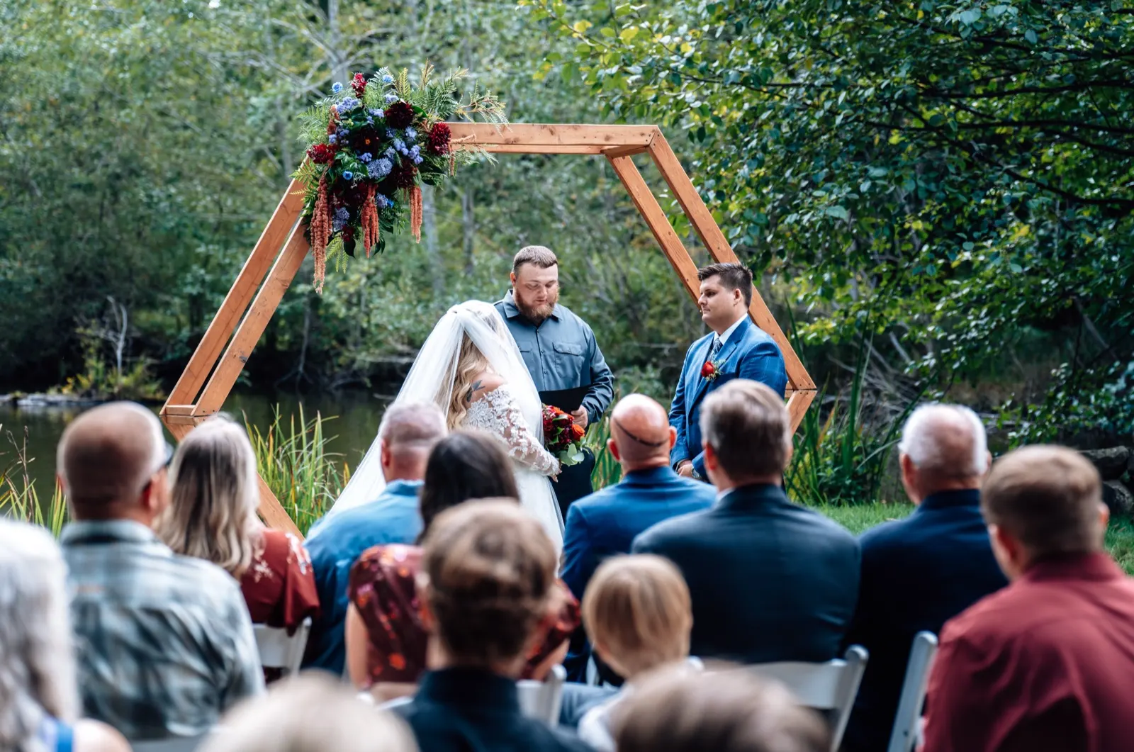
FAA Part 107 certified commercial drone photography and videography across Northern Arizona and California's North Coast, a three-platform fleet covering everything from sub-250g travel work to broadcast-grade cinema and cinematic FPV. Broadcast-grade aerial cinema for real estate, wedding films, brand campaigns, event coverage, and inspections. Licensed, insured, and current.
FAA Part 107 · The Operator
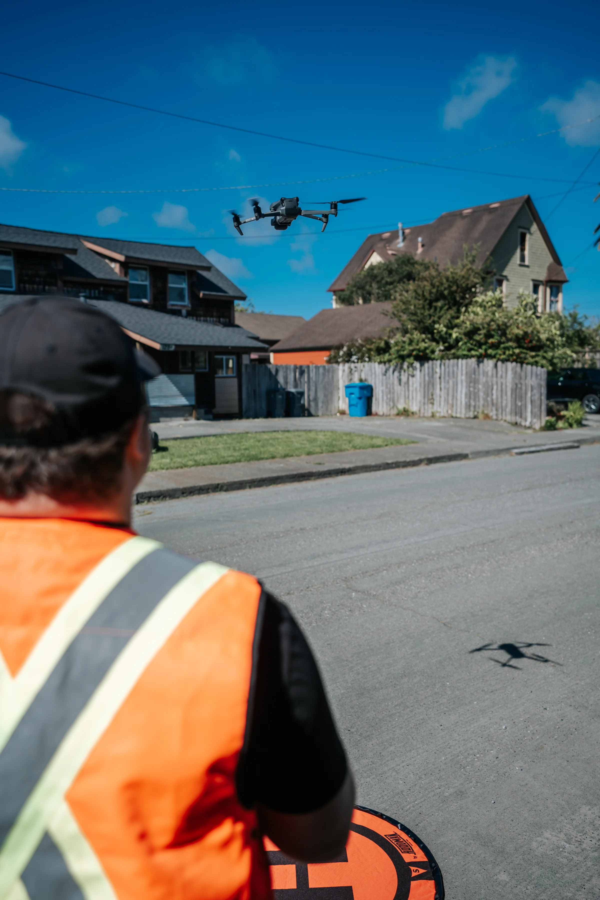
The pilot, on every flight.
Every drone flight on the calendar is operated personally by Tex. FAA Part 107 commercial Remote Pilot Certificate current and valid, LAANC airspace coordination handled in-house, and a working knowledge of the North Coast's microclimate wind patterns built from years of flying over the coastline, redwoods, and ranch country.
The Approach
Licensed, insured, and FAA Part 107 certified.
Commercial drone work is a regulated space. Every flight I run is in compliance with FAA Part 107, appropriate airspace authorization, documented insurance, written property-owner permission for private land, and a pre-flight risk assessment.
The license isn't a formality. Any aerial photo or video tied to a business, a real estate listing, a marketing campaign, a brand social post, a wedding film a vendor charges money for, falls under FAA Part 107. Flying that work without the certificate is a federal violation, not a gray area. The FAA's civil penalty framework allows fines that escalate into the tens of thousands of dollars per violation; the agency has pursued aerial photographers, real estate teams, marketing agencies, and 'I just have a DJI' side-hustle operators alike. SkyPan International was fined $200,000 in a high-profile settlement for unauthorized urban flights. Real estate brokerages have been put on notice for posting unlicensed aerial footage to MLS listings. The enforcement is real and it's ongoing.
There's also a quieter exposure most clients don't think about: insurance. Standard commercial liability policies won't pay out on a flight that broke FAA rules. If something goes wrong on an unlicensed shoot, a drone hits a vehicle, a roof, a guest, a power line, the damages land on whoever paid for the project. Hiring a Part 107-certified, registered, insured pilot transfers that exposure off your books and onto mine, where it belongs. You get a documented paper trail for every flight (LAANC clearance, COI, property-owner releases) and footage you can legally use without risk.
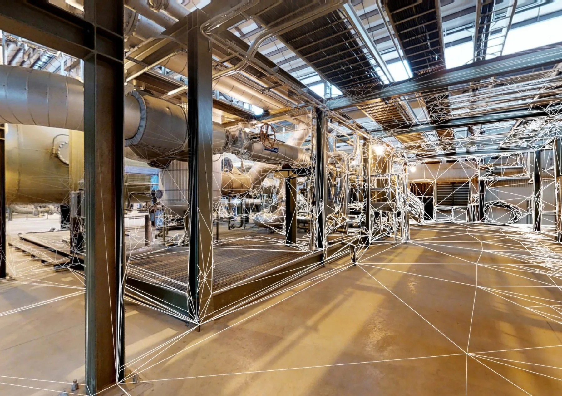
On the production side, I fly a three-platform fleet so the right drone goes up for every job: a DJI Mini 3 for sub-250g flights in tight regulated airspace and travel work, the DJI Mavic 3 Pro for most commercial cinema (broadcast-grade 4K, Hasselblad sensor, three-camera array with obstacle avoidance for tight architectural and industrial environments), and the DJI Avata 2 for cinematic FPV, immersive single-take flythroughs through redwood canopy, warehouses, and event spaces. I plan flights against forecast windows so monsoon wind in Arizona and coastal fog in California don't compromise the footage.
Deliverables range from stand-alone drone reels to fully integrated drone-plus-ground campaigns. Most clients book drone work alongside ground photo + video for a complete package.
Equipment
- DJI Mini 3 (sub-250g, regulated airspace + travel)
- DJI Mavic 3 Pro (broadcast-grade 4K, Hasselblad)
- DJI Avata 2 (cinematic FPV)
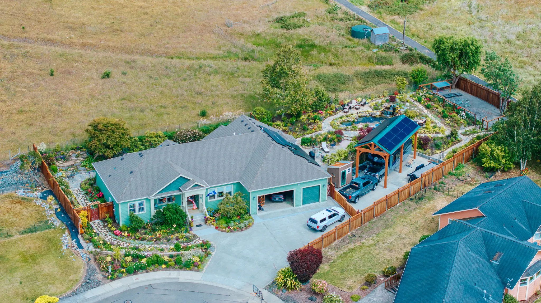
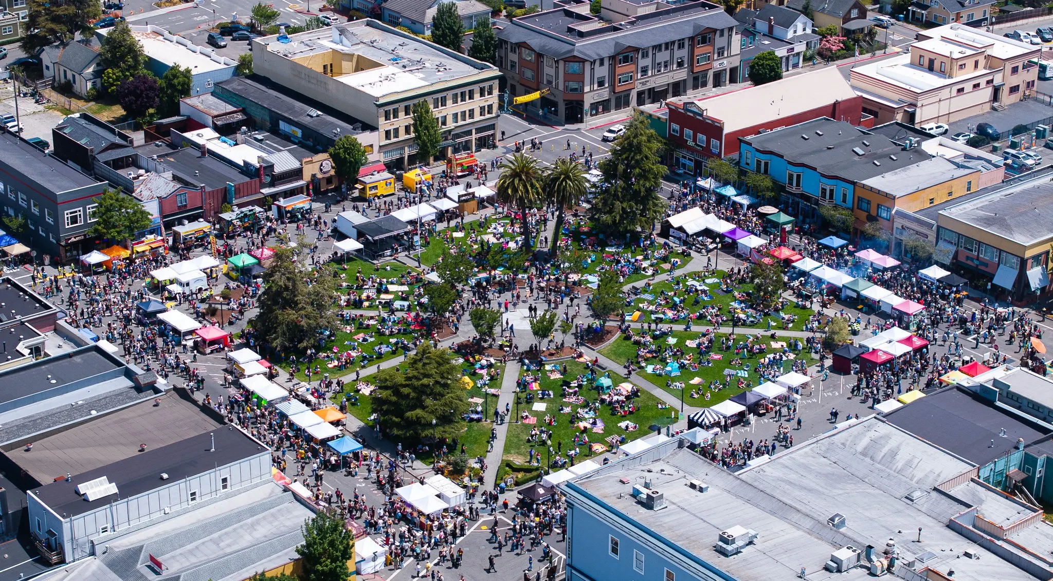
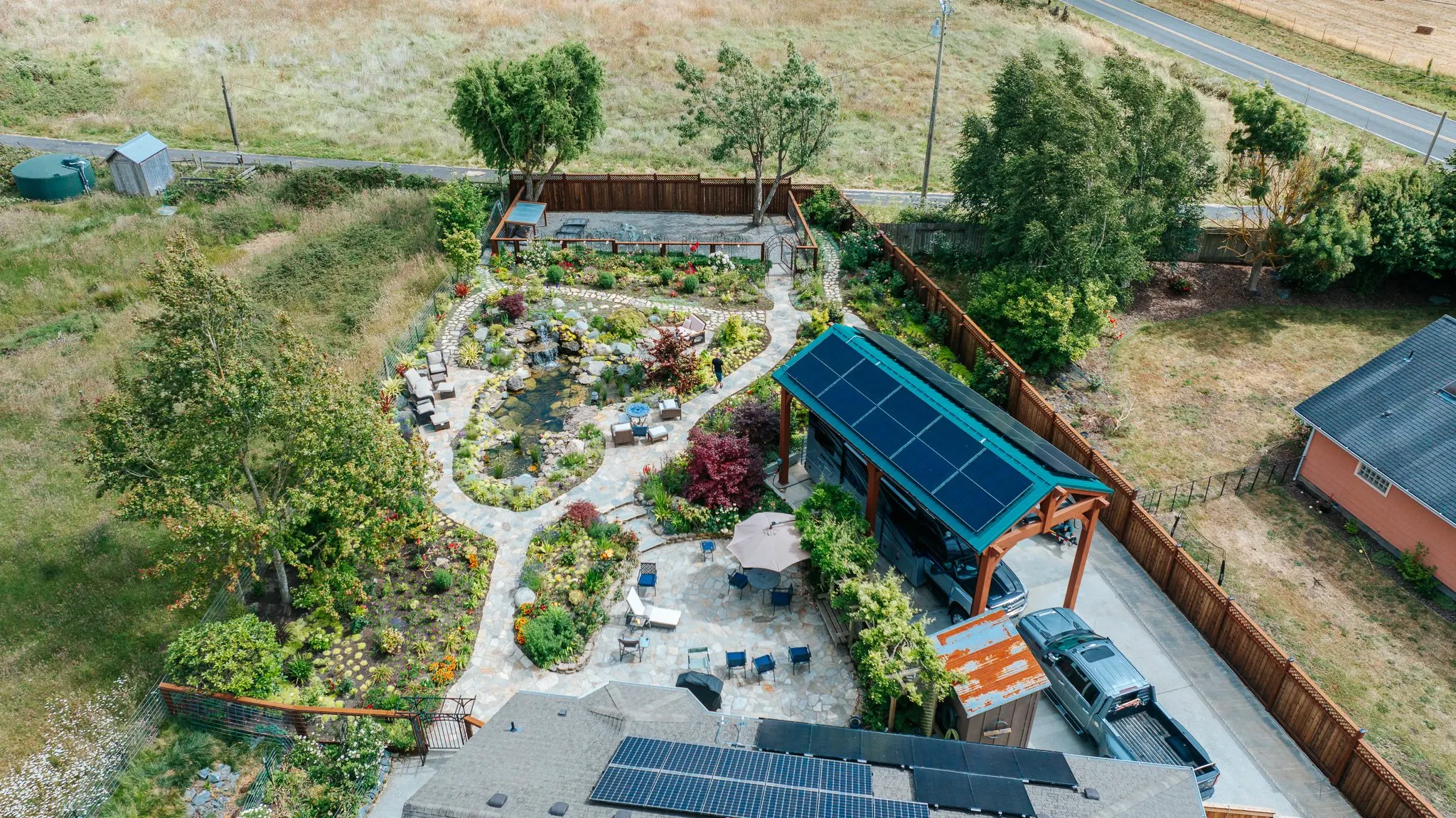
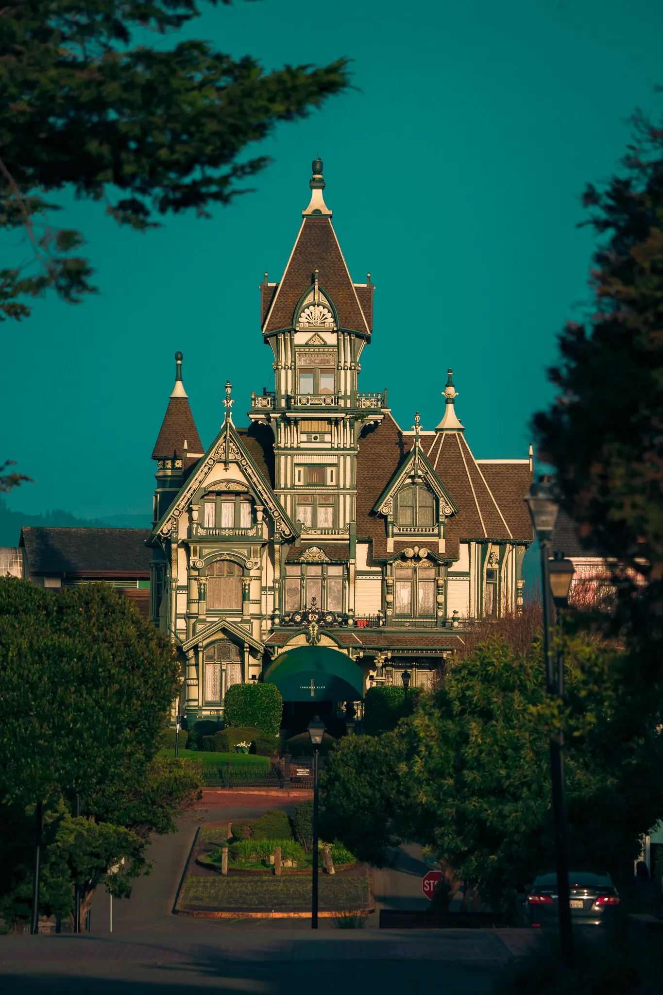
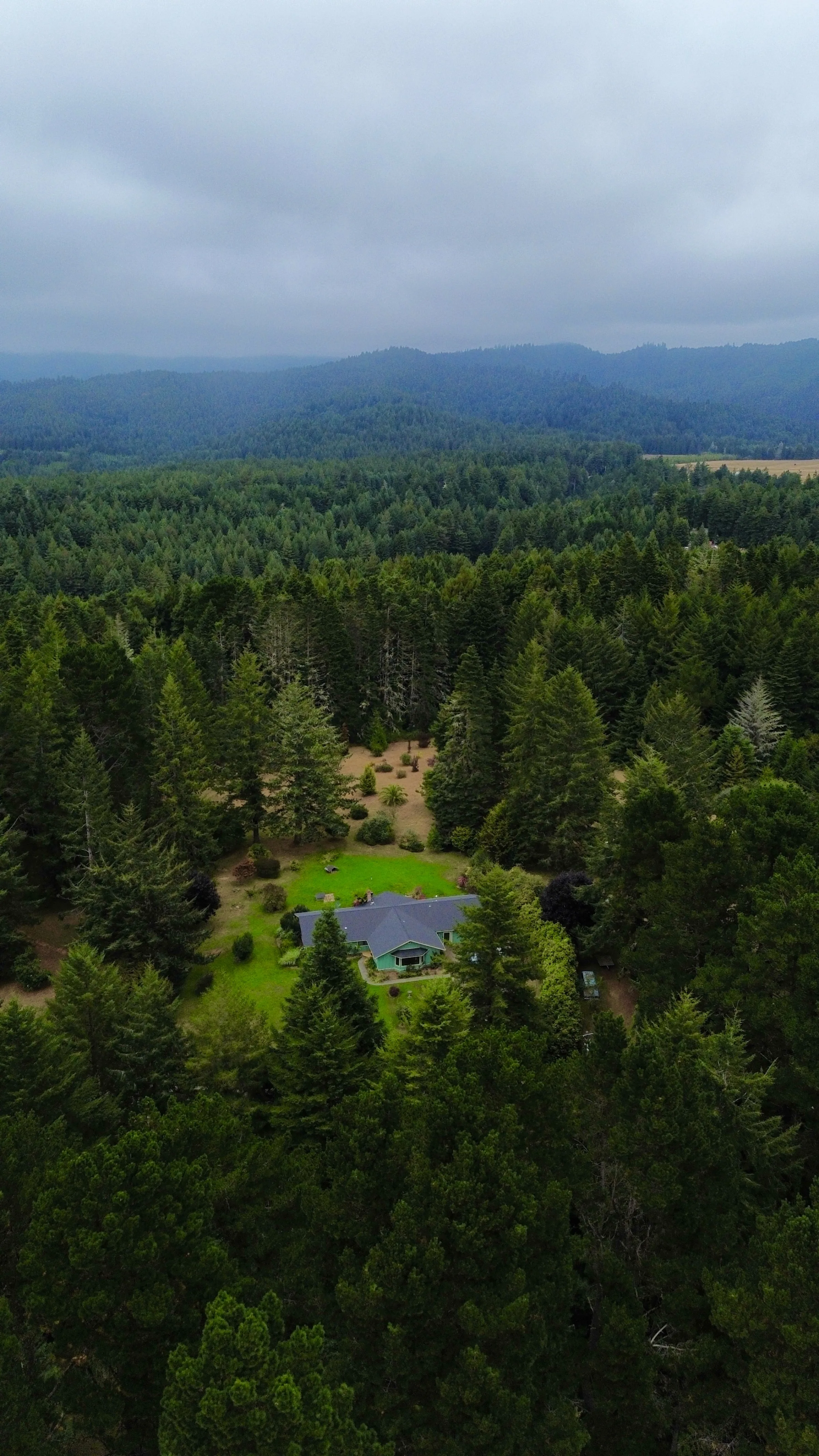
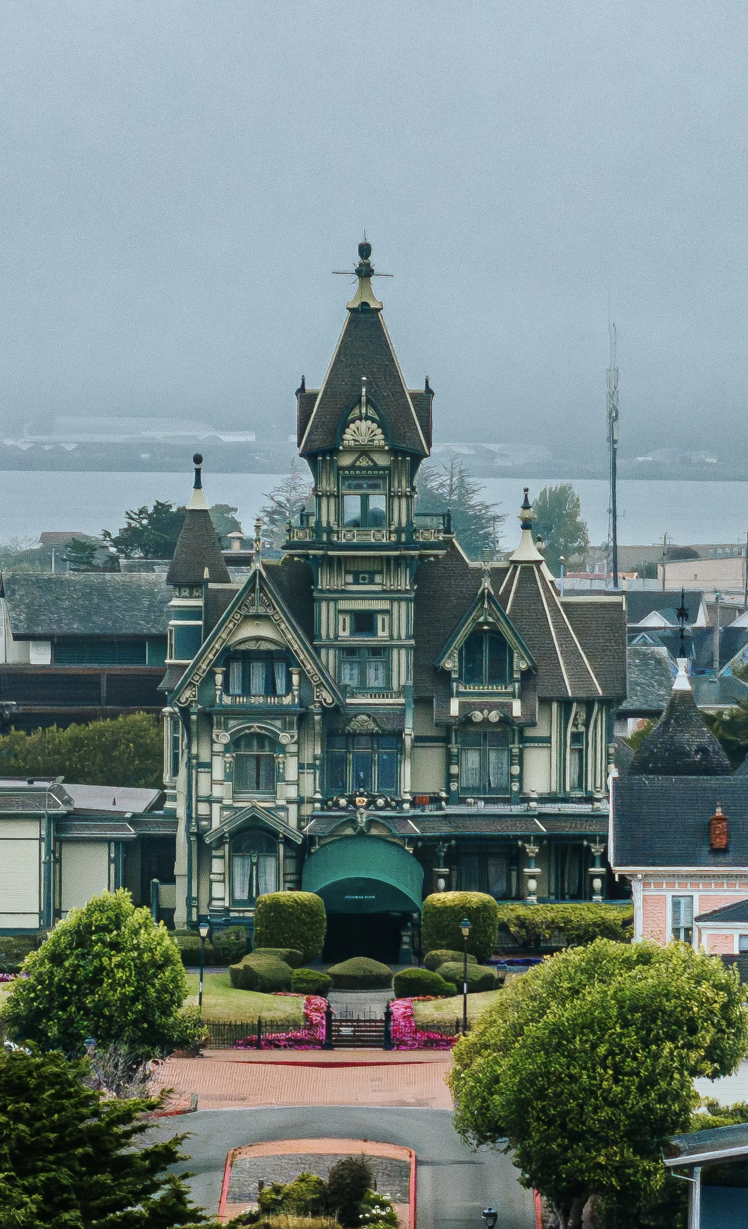
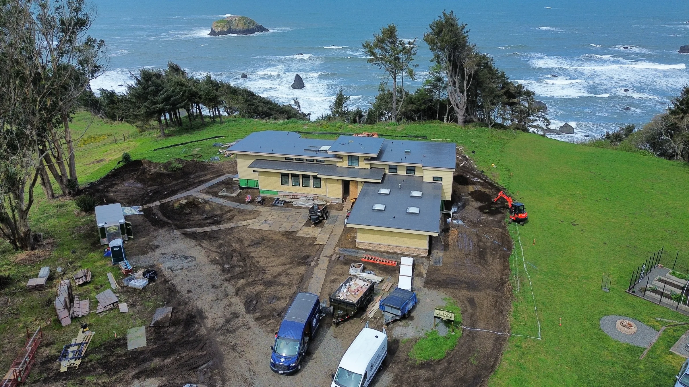
Selected Work
Drone Photography and Videography. A look at the work.
What's Included
What you actually get with drone photography and videography.
-
FAA Part 107 Certified Pilot
Current, registered, and current commercial drone pilot license. LAANC airspace authorization for restricted areas. Insurance documentation on request.
-
Three-Platform Drone Fleet
DJI Mini 3 (sub-250g, for tight regulated airspace and travel); DJI Mavic 3 Pro (broadcast-grade 4K cinema, Hasselblad sensor, three-camera array); DJI Avata 2 (cinematic FPV, immersive single-take flythroughs). The right drone for the right job, every time.
-
Pre-Flight Risk Assessment
Documented airspace check, weather review, property-owner permission, and flight plan for every commercial flight.
-
Commercial Insurance
Fully insured for commercial drone operations. Certificate of insurance available before the shoot for venue or client requirements.
-
Edited Aerial Deliverables
Color-graded 4K video clips, high-resolution stills, and any specialty formats (vertical for social, broadcast 16:9, slow-motion sequences).
-
Permit Coordination
FAA LAANC clearance, state park permits, and venue authorizations handled ahead of the shoot, no day-of surprises.
Cities Served
Drone Photography and Videography in 28 priority cities.
Each city below has its own dedicated drone photography and videography page with venue notes, microclimate context, and city-specific FAQs. Click into the city closest to you.
-
Maricopa County
Phoenix
Drone Photography and Videography in Phoenix → -
Maricopa County
Scottsdale
Drone Photography and Videography in Scottsdale → -
Maricopa County
Mesa
Drone Photography and Videography in Mesa → -
Maricopa County
Tempe
Drone Photography and Videography in Tempe → -
Maricopa County
Chandler
Drone Photography and Videography in Chandler → -
Maricopa County
Gilbert
Drone Photography and Videography in Gilbert → -
Pima County
Tucson
Drone Photography and Videography in Tucson → -
Pima County
Oro Valley
Drone Photography and Videography in Oro Valley → -
Pima County
Marana
Drone Photography and Videography in Marana → -
Yavapai County
Prescott Valley
Drone Photography and Videography in Prescott Valley → -
Yavapai County
Sedona
Drone Photography and Videography in Sedona → -
Yavapai County
Prescott
Drone Photography and Videography in Prescott → -
Yavapai County
Chino Valley
Drone Photography and Videography in Chino Valley → -
Yavapai County
Cottonwood
Drone Photography and Videography in Cottonwood → -
Coconino County
Flagstaff
Drone Photography and Videography in Flagstaff → -
Coconino County
Page
Drone Photography and Videography in Page → -
Coconino County
Williams
Drone Photography and Videography in Williams → -
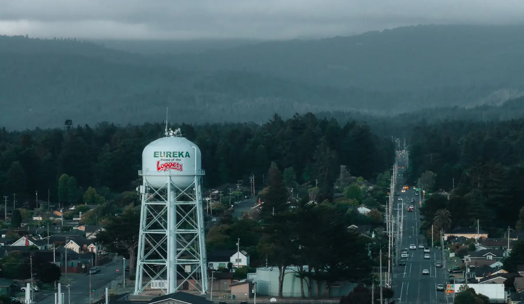
Humboldt County
Eureka
Drone Photography and Videography in Eureka → -
Humboldt County
Arcata
Drone Photography and Videography in Arcata → -
Humboldt County
Trinidad
Drone Photography and Videography in Trinidad → -
Del Norte County
Crescent City
Drone Photography and Videography in Crescent City → -

Mendocino County
Mendocino
Drone Photography and Videography in Mendocino → -
Humboldt County
Ferndale
Drone Photography and Videography in Ferndale → -
Humboldt County
Fortuna
Drone Photography and Videography in Fortuna → -
Humboldt County
McKinleyville
Drone Photography and Videography in McKinleyville → -
Mendocino County
Fort Bragg
Drone Photography and Videography in Fort Bragg → -
Mendocino County
Boonville
Drone Photography and Videography in Boonville → -
Mendocino County
Point Arena
Drone Photography and Videography in Point Arena →
By County
Drone Photography and Videography across multiple counties.
Each county hub has dedicated drone photography and videography content for the entire region, venues, microclimate, and process specific to that county, across both the California and Northern Arizona service areas.
-
Yavapai County · Arizona
Drone Photography and Videography in Yavapai County
The Prescott metro. Prescott, Prescott Valley, Chino Valley, the Verde Valley wine country, and the red rock arts town of Sedona. Mile-high climate, dark skies, and the anchor of Tex's born-and-raised Arizona service area.
Explore Yavapai County → -
Coconino County · Arizona
Drone Photography and Videography in Coconino County
Flagstaff, Williams, Page, and the south rim of the Grand Canyon, one of the largest counties in the country geographically, anchored by Northern Arizona University and the destination tourism economy across the Colorado Plateau.
Explore Coconino County → -
Maricopa County · Arizona
Drone Photography and Videography in Maricopa County
The Phoenix metro, the Valley of the Sun. Phoenix, Scottsdale, Mesa, Tempe, Chandler, and Gilbert, an hour and a half south of the Prescott Valley home base. The largest market in Arizona for weddings, real estate media, commercial production, and brand work.
Explore Maricopa County → -
Pima County · Arizona
Drone Photography and Videography in Pima County
Tucson and the southern Arizona desert. The Old Pueblo, Oro Valley, and Marana, ringed by Saguaro National Park and the Santa Catalina Mountains. Arizona's second-largest metro, a destination market for weddings, real estate, and brand work in the most dramatic stretch of the Sonoran Desert.
Explore Pima County → -
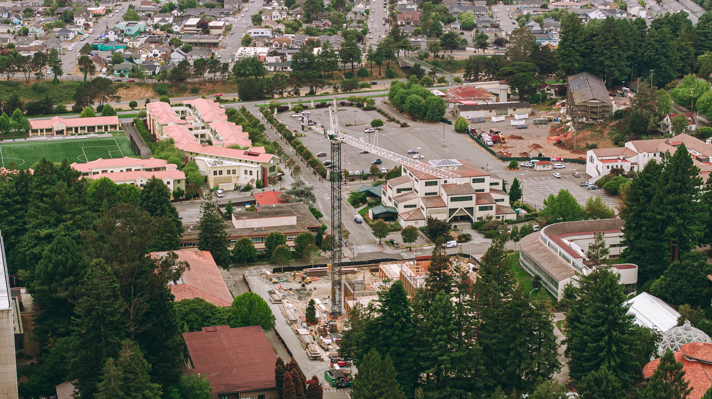
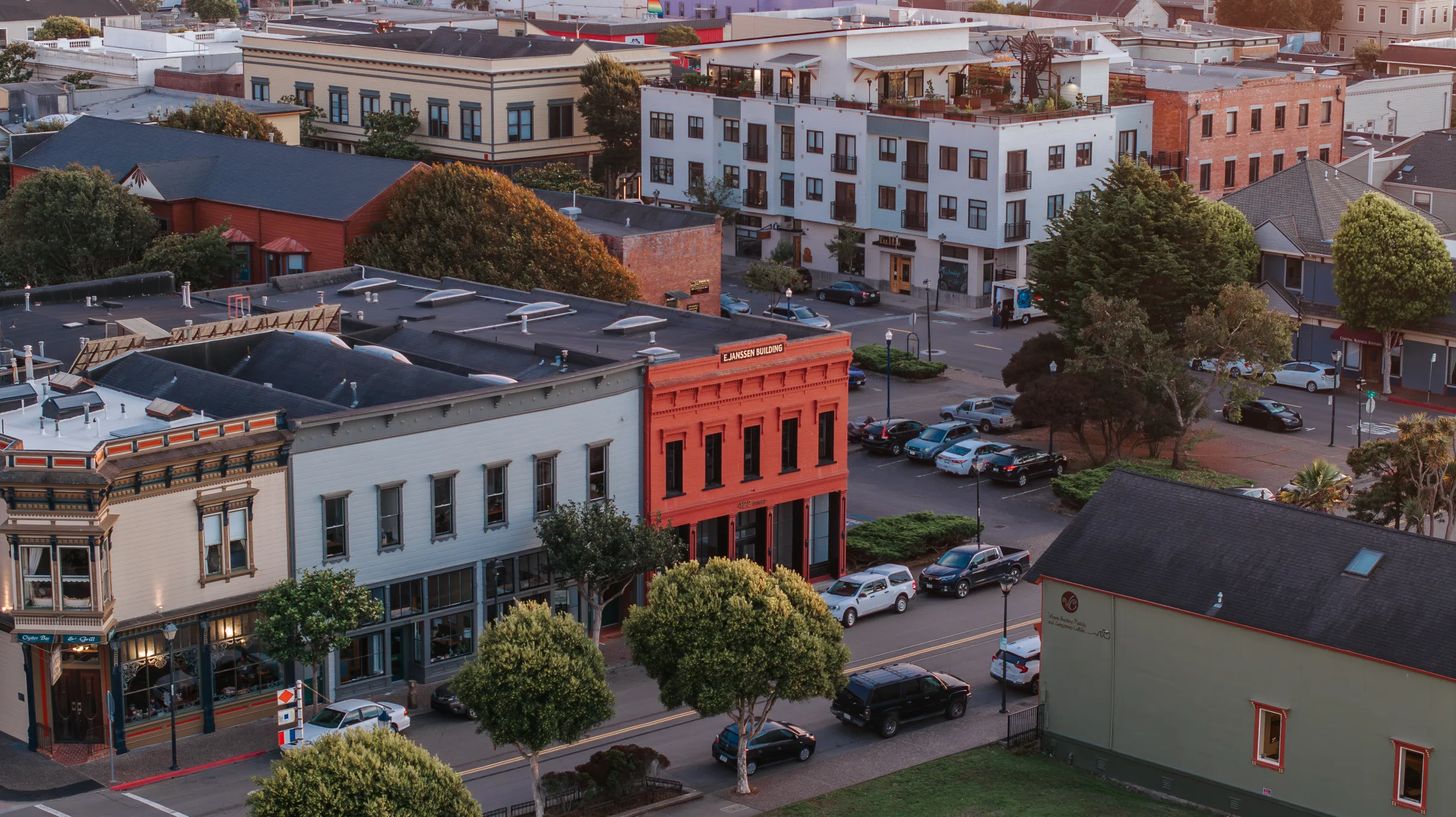
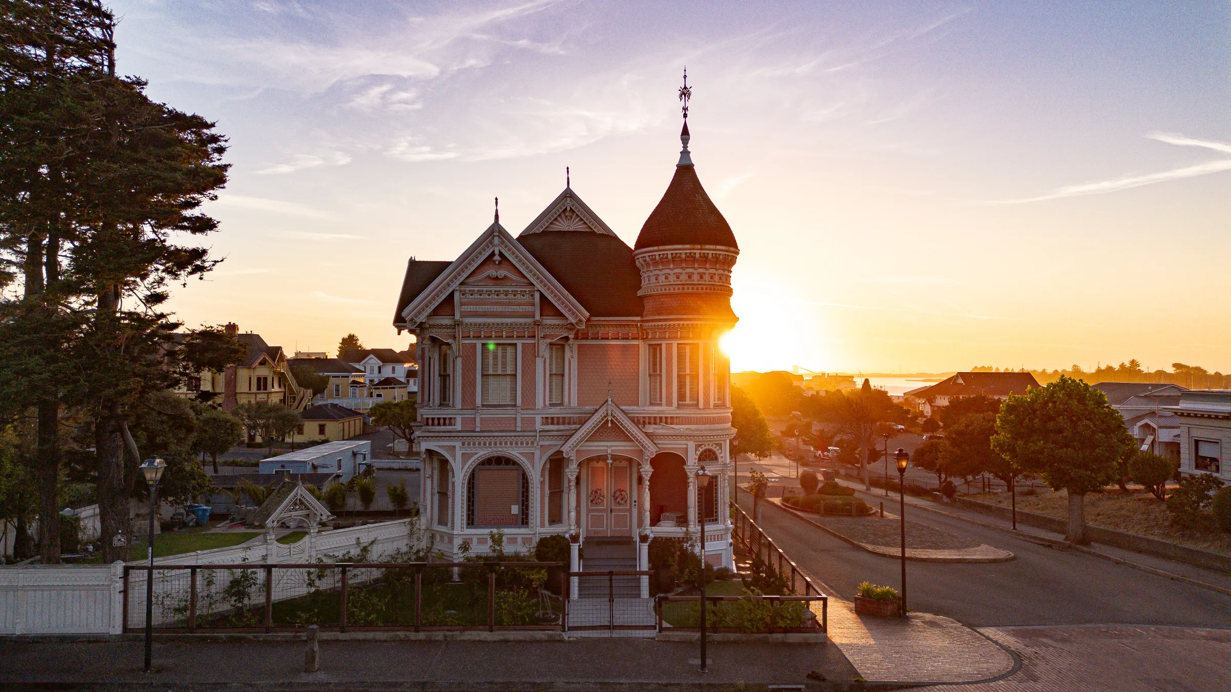
Humboldt County · California
Drone Photography and Videography in Humboldt County
California's redwood coast, coastline, ancient forests, agricultural valleys, and the cities of Eureka, Arcata, Fortuna, Ferndale, and Trinidad. A longtime Tex Kelly Productions service market.
Explore Humboldt County → -
Del Norte County · California
Drone Photography and Videography in Del Norte County
California's northernmost coastal county. Crescent City, Smith River, Klamath, and the Redwood National and State Parks corridor. Destination weddings and remote drone work.
Explore Del Norte County → -
Mendocino County · California
Drone Photography and Videography in Mendocino County
Wine-country logistics inland, dramatic coastline outward. Ukiah, Fort Bragg, Mendocino, and the Anderson Valley. Wedding venues, vineyard productions, and small-city brand work.
Explore Mendocino County →
Also Served
Other cities I operate a drone in.
-
Loleta
→Eel River delta and dairy-country aerials, pastoral pattern shots and ag-brand work.
-
Scotia
→Timber-mill and Eel River industrial aerials. Class G airspace, ideal for infrastructure documentation.
-
Garberville
→Avenue of the Giants gateway, redwood-canopy aerial sweeps and southern Humboldt destination flights.
-
Orick
→Redwood National Park elk meadows, Fern Canyon corridor, Gold Bluffs Beach. Class G coastal aerials.
-
Honeydew
→Lost Coast aerial, remote, dramatic, unobstructed Class G airspace.
-
Smith River
→Lily-field patterns, crystal-clear river aerials, and Oregon-border coastal flights.
-
Klamath
→Redwood National Park and Klamath River-mouth aerials, destination drone work for tourism + editorial.
How It Works
From first message to final delivery.
- 01
Inquiry & Scope
Send the location, intended use (real estate, wedding, brand, industrial), and timeline. I pull the airspace map for the location.
- 02
Authorization
LAANC permit if needed (1–14 days lead time depending on airspace). Property owner releases for private land.
- 03
Weather Window
I monitor forecasts and identify the best-light, lowest-wind window. Coastal Humboldt fog often dictates timing.
- 04
The Flight
On-site arrival 30 minutes early for visual airspace check. Pre-flight checklist. Multiple altitude and angle passes for editorial flexibility.
- 05
Post-Production
Color grade, stabilization polish, format export. Standard turnaround 1–2 weeks for video, 3–5 days for still imagery.
Investment
Drone work is priced per shoot, half-day, full-day, and multi-day rates scale with scope. Most real estate aerials run a few hundred; wedding integrations and brand campaigns scale up. Send the project and timeline for a quote.
Drone Photography and Videography FAQs
Common questions.
-
Are you FAA Part 107 certified?
Yes. Tex is FAA Part 107 certified, fully insured, and operates as a licensed commercial drone pilot. All flights comply with FAA regulations including airspace authorization, altitude limits, and visual line-of-sight requirements. Insurance documentation is available on request. -
What can drone footage be used for?
Wedding aerials, real estate listings, brand and commercial campaigns, event coverage, construction progress documentation, industrial inspections, and editorial storytelling. Output ranges from short Instagram clips to broadcast-grade 4K cinema and high-resolution stills for print. -
What about restricted airspace?
Most of Humboldt County is unrestricted Class G airspace, but locations near the Eureka airport, Arcata airport, or military airspace require pre-flight FAA authorization. Tex handles all permitting through LAANC. Plan two extra days of lead time for restricted areas. -
Can you fly over private property?
Yes, with the property owner's written permission. Tex provides a release form for property owners. For shoots over public land, we follow Park Service and BLM regulations, some redwood and state parks require special permits, which Tex coordinates ahead of the shoot. -
What weather conditions limit drone work?
Coastal fog, sustained winds above 25 mph, and rain are the main limits. Tex monitors forecasts in the days leading up to a shoot and will reschedule if conditions don't allow safe flight or quality footage. Coastal Humboldt fog can lift mid-morning, so we often plan flights for a forecast window with a backup time.
Guides & Reading
Read up before you reach out.
-
Arizona Real Estate Video and Media: What Actually Sells a Listing
Matterport 3D tours, drone aerial, and cinematic listing video for Arizona real estate. Why out-of-state buyers make media the difference in Phoenix, Scottsdale, and across the state.
Read -
Why hiring an FAA Part 107 drone pilot matters
Why the FAA Part 107 certification is the difference between hobby drone footage and footage you can legally use for commercial work.
Read
Industries
Drone Photography and Videography for the businesses I work with.
-
HVAC
Marketing, video, and lead generation for HVAC contractors.
See the work -
Roofing
Drone aerial cinematography + storm-season lead campaigns for roofing contractors.
See the work -
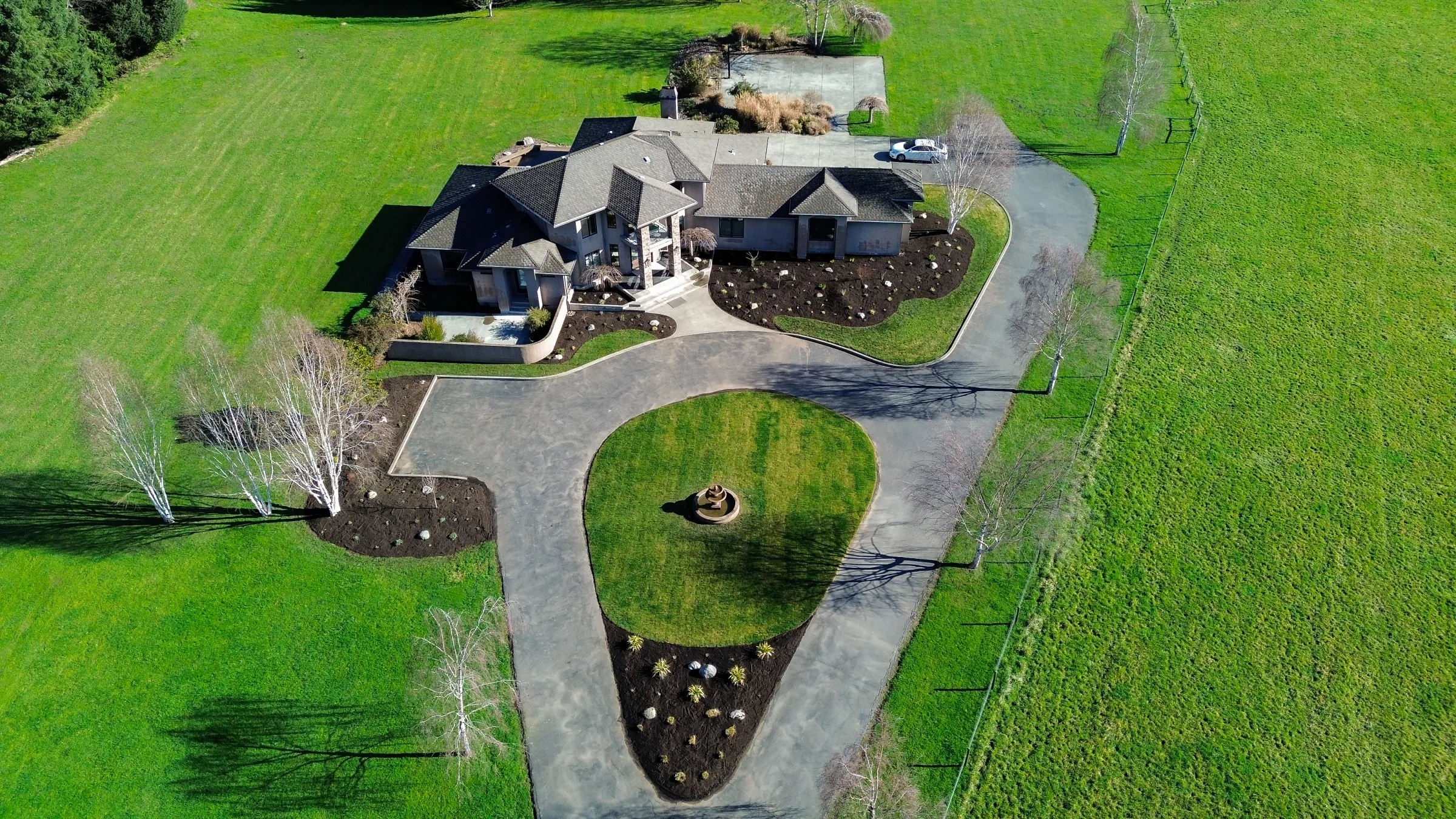
Real Estate
Drone aerial, Matterport 3D tours, personal brand video, and listing marketing for agents.
See the work -
General Contractors
Project documentation, brand cinematography, and lead generation for builders.
See the work -
Landscaping
Drone aerial cinematography and before/after content for landscape contractors.
See the work
Inquire
Tell me about your drone project.
Related Services
Often booked alongside this.
-
creative
Photography
Editorial, commercial, and lifestyle photography. Award-winning, FAA Part 107 aerial-capable.
Explore -
industrial
Matterport
Matterport 3D tours and virtual walkthroughs for real estate, construction, and resort properties.
Explore -
creative
Weddings
Cinematic films and editorial photography for weddings.
Explore - Services Hub
All Ten Services
Photography, video, weddings, drone, portraits, proposals, marketing, AI, web, and LiDAR.