
Arizona
LiDAR Scanning in Arizona.
Matterport Pro3 reality capture and digital twin deliverables. Serving Prescott, Prescott Valley, Sedona, Flagstaff, and the Phoenix metro, from a Prescott Valley native.
Statewide
One studio, the whole state.
Tex was born and raised in Prescott Valley, so Arizona is home, not a market someone parachutes into. LiDAR Scanning work runs from the mile-high Prescott area, Sedona's red rock, and the Flagstaff high country down to the Phoenix metro, Scottsdale, Mesa, Tempe, Chandler, and Gilbert. The studio built its track record and its 100-plus five-star reviews in California, and that same eye now serves the state.
Pick your city below and you'll land on the page built for it, with the local venues, the seasons, and the details that actually matter there. If you're not sure where you fit, tell me what you're planning and we'll sort it out.
Where I Work
LiDAR Scanning across Arizona.
See the full lidar service, or the whole Arizona service area.
FAQ
LiDAR Scanning in Arizona, answered.
-
What is LiDAR and a digital twin?
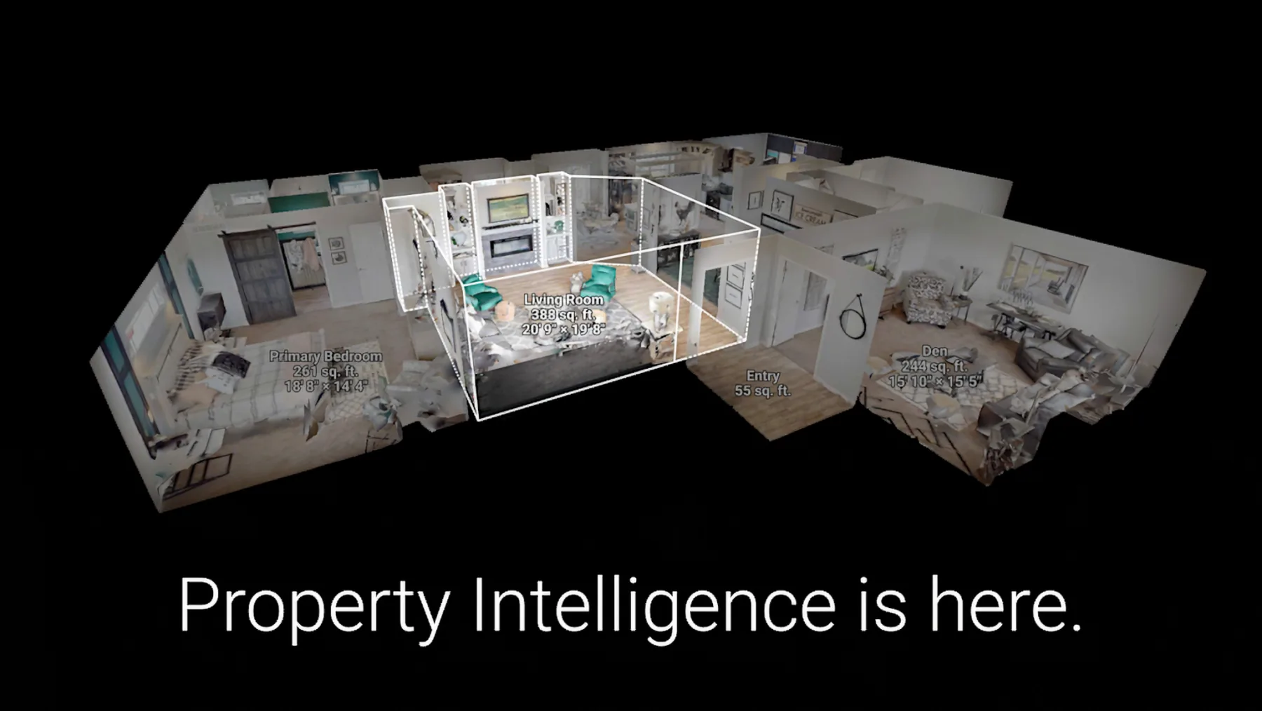
LiDAR (Light Detection and Ranging) is high-precision 3D scanning that captures a space as a measurable, navigable model. A digital twin is the resulting 3D representation, a fully accurate spatial record clients can walk through, measure, and overlay design changes onto. Useful for industrial, commercial, and infrastructure documentation. -
Who is this service for?
Architects capturing existing conditions before a renovation, general contractors documenting construction progress and closeout, engineers and building owners who need measurable as-builts, and historic-preservation projects. Anyone who needs measurable spatial documentation that goes beyond photography. -
How long does a scan take?
Depends on scope. A single floor of a small commercial building can be scanned in 2–4 hours; a large multi-floor building or equipment-dense facility takes a full day or more. Tex provides a timeline as part of every project quote. -
What deliverables do clients receive?
Scan-to-CAD drawings drawn straight from the scan: DWG floor plans, reflected ceiling plans, interior and exterior elevations, and building sections. Plus registered E57 point clouds, an existing-conditions package, accurate measurement data, high-resolution stills from any angle, and an interactive 3D walkthrough you open in a browser. We deliver the finished CAD drawings, or hand off the registered point cloud for your own team to model. Output format is scoped per project. -
Do I need a full Revit/BIM model, or is scan-to-CAD enough?
Most projects that just need accurate as-built drawings, floor plans, elevations, sections, do not need a full parametric Revit model, and paying for one is money spent on modeling you will not use. Scan-to-CAD gets you clean, measurable drawings faster and for less. Full BIM earns its cost when you are running a large renovation or ongoing facility management off a live model. We scope which one your project actually needs on the first call so you are not overbuying. -
Can you scan a building that is occupied or still in operation?
Yes, and most commercial jobs are exactly that. We schedule around occupancy: off-hours, a floor or zone at a time, or during a planned shutdown window. The scanner captures a space quickly and without tearing anything apart, which is why occupied offices, running healthcare facilities, and active industrial plants are routine. Tell us the access constraints up front and we build the capture plan around them. -
How does this compare to photogrammetry or drone mapping?
The Matterport Pro3 captures LiDAR-based spatial data at centimeter-level accuracy (about ±20mm), ideal for interiors, equipment-dense environments, and existing-conditions documentation. For large outdoor sites where coverage matters more than per-point accuracy, drone aerial photogrammetry is the better tool. For many projects, the two are combined. -
How accurate is the scan?
The Matterport Pro3 captures with LiDAR at centimeter-level accuracy, roughly ±20mm under typical conditions. That's the right grade for existing-conditions documentation, as-built floor plans, renovation and tenant-improvement planning, progress tracking, and clearance checks. It is not survey-grade; when a project needs survey tolerances or geo-referenced control, we bring in a licensed survey partner. Project-specific accuracy targets are confirmed in the proposal. -
Can I get a Revit, AutoCAD, or BIM model from the scan?
Yes. Point cloud exports are compatible with Autodesk Revit, AutoCAD, Navisworks, and other CAD/BIM workflows. We can hand off raw point clouds for your in-house team to model, or coordinate scan-to-BIM modeling with an AEC partner for clients who need a delivered Revit model. Output format is scoped per project, let us know what your downstream workflow looks like. -
How is the digital twin delivered? Do I need special software?
The digital twin is delivered as a web-accessible link, clients open it in any browser, no software install required. From the browser you can navigate the space, take measurements, drop notes, and share access with stakeholders. Raw point cloud and CAD-compatible exports are available on request for technical workflows.
Anywhere in Arizona
Tell me about your project.
LiDAR Scanning from Prescott Valley to Phoenix. Every inquiry gets a personal reply within 24 hours.